GHD is a global, multidisciplinary professional services network providing clients with integrated solutions across advisory, digital, engineering, architecture, environmental and construction.
GeoMate specializes in transforming aerial imagery into compact, high-definition maps using AI-driven automation. Our solution provides partners with detailed spatial data quickly, safely, and cost-effectively - without the need for traditional field surveys.
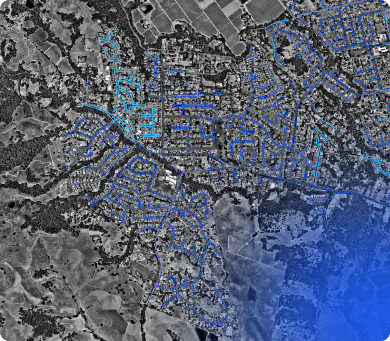
One of the most critical elements of a transportation master plan is accurate infrastructure data.
To support Napa County’s Transportation Master Plan commissioned by the Napa Valley Transportation Authority (NVTA), GHD required an up-to-date sidewalk dataset to better understand existing infrastructure and identify network gaps.
And that’s where we came in.
As part of this comprehensive transportation overhaul, GHD partnered with GeoMate in 2024, leveraging our AI-powered mapping solution to efficiently map sidewalk presence, width, and missing links across the county.


Accelerated delivery timelines
Delivered a full county-wide sidewalk map in just four months (Sept–Dec 2024), far outpacing traditional field survey timelines.
Mapped 748 square miles across all five cities and surrounding unincorporated areas.

High-resolution, actionable data
Provided detailed sidewalk presence, width, and connectivity attributes to support accurate gap analysis and prioritization.
A unified dataset now supports coordinated planning across Napa, American Canyon, Calistoga, St. Helena, Yountville, and county regions.

Survey-free workflow
AI analysis of aerial imagery replaced time-intensive fieldwork, reducing costs and creating a scalable approach for ongoing infrastructure updates.

Learn More