
Cities operate in constant change — construction, incidents, transit priority, curb management, seasonal demand. Traditional one-off traffic studies cannot keep up. GeoMate delivers micro- and meso-scale traffic simulation and predictive insights — built on a lane-level digital twin foundation.
Contact UsCities need continuous, scenario-based traffic intelligence — not isolated reports.
Learn More

Static and one-time
Traffic studies are produced as one-off reports and quickly become outdated as city conditions evolve.
%201.png)
Based on assumptions instead of real data
Models rely on simplified assumptions rather than real-world traffic behavior and observations.
%201.png)
Difficult to update when conditions change
Updating models after construction, policy changes, or incidents requires time-consuming manual work.

Limited to single intersections or corridors
Analysis often focuses on isolated locations instead of understanding citywide traffic dynamics.
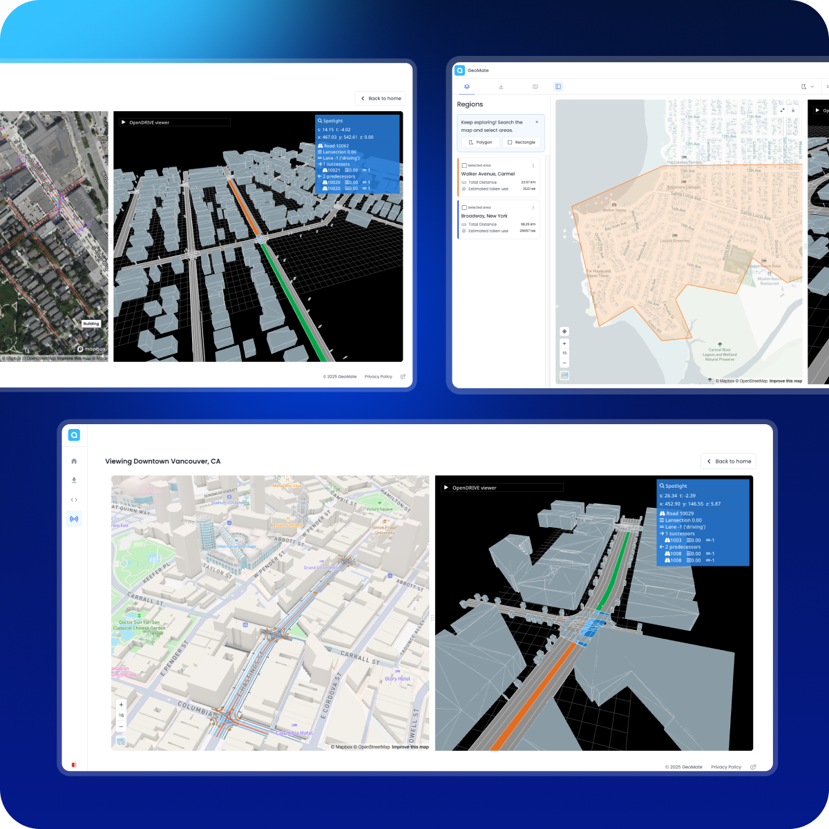
RealSimE transforms road data and imagery into a lane-accurate, simulation-ready digital representation of city streets.

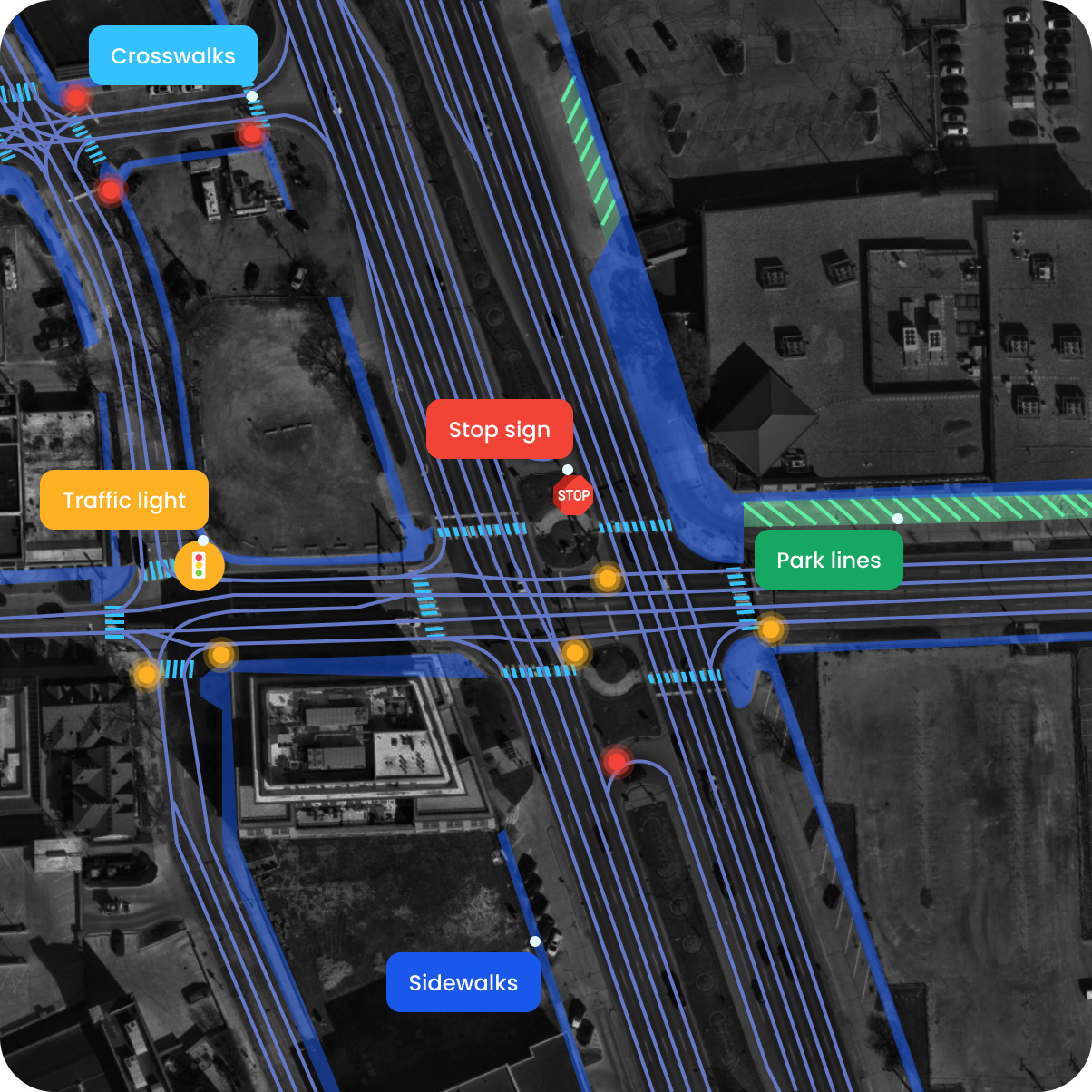
Lane-level geometry and topology
%201.png)
Intersection and corridor connectivity

A reusable spatial source of truth
%201.png)
Compatible with simulation and operational workflows
RealSimE transforms road data and imagery into a lane-accurate, simulation-ready digital representation of city streets.
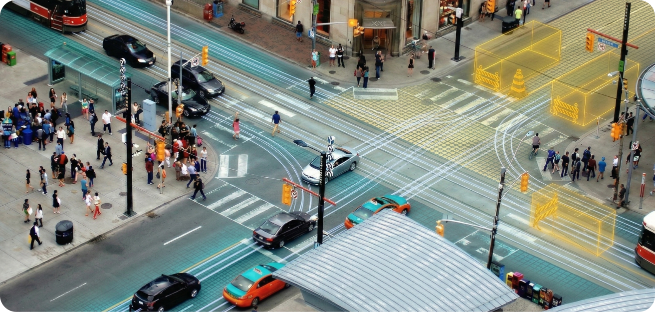
Get StartedThis transforms real-world signals into testable, measurable scenarios.

On top of the digital twin, cities can integrate
- Mobile / probe travel time data
- Sensors, counts, and historical traffic patterns
- Incidents, construction, and planned events
- Camera detections and turning movements

Cities can then define scenarios
- Lane closures and detours
- Demand shifts
- Time and location-based operational changes
- Transit priority and curb policies

From simulation to actionable outputs, cities receive
- Travel time and reliability metrics
- Bottleneck and hotspot identification
- Queueing and spillback risk indicators
- Scenario-based CO₂ and emissions estimates
- Before/after comparisons

Used for
- Construction and detour impact assessment
- Vision Zero and road safety analysis
- Transit priority and corridor optimization
- Climate and sustainability reporting
- Evaluating trade-offs between mobility, safety, and emissions

Learn More


