

Cities are changing faster than ever.
Construction projects, transit upgrades, curb redesigns, special events, and unexpected incidents all impact how traffic moves every single day. Yet many decisions are still made using static traffic studies that reflect a single moment in time.
That approach no longer works.
Modern cities need traffic intelligence that evolves as quickly as their streets do.
Traditional traffic models were built for long planning cycles. They remain valuable tools, but they weren’t designed for today’s dynamic, rapidly shifting urban environments.
The challenge is that static studies age quickly. A model completed last year may no longer reflect today’s traffic patterns, new developments, or shifting travel behavior. They also tend to oversimplify reality. Corridor-level assumptions often miss what’s happening at the lane level - where congestion forms, delays compound, and safety risks emerge.
Most importantly, static models limit confidence. When cities test construction plans, transit priority lanes, or detours, they cannot fully predict how those changes will ripple across the broader network.
Cities deserve better visibility before committing time, funding, and public trust.
GeoMate enables what we call Living Traffic Intelligence; a continuously updated, high-fidelity understanding of how traffic behaves and how it responds to change.
Instead of relying on assumptions, cities can use real-world data combined with advanced simulation to test “what-if” scenarios before implementation. This approach reduces risk in construction and infrastructure changes, improves traffic operations in real time, and enables measurable tracking of mobility, safety, and environmental performance.
It’s the difference between reacting to congestion and planning for it.
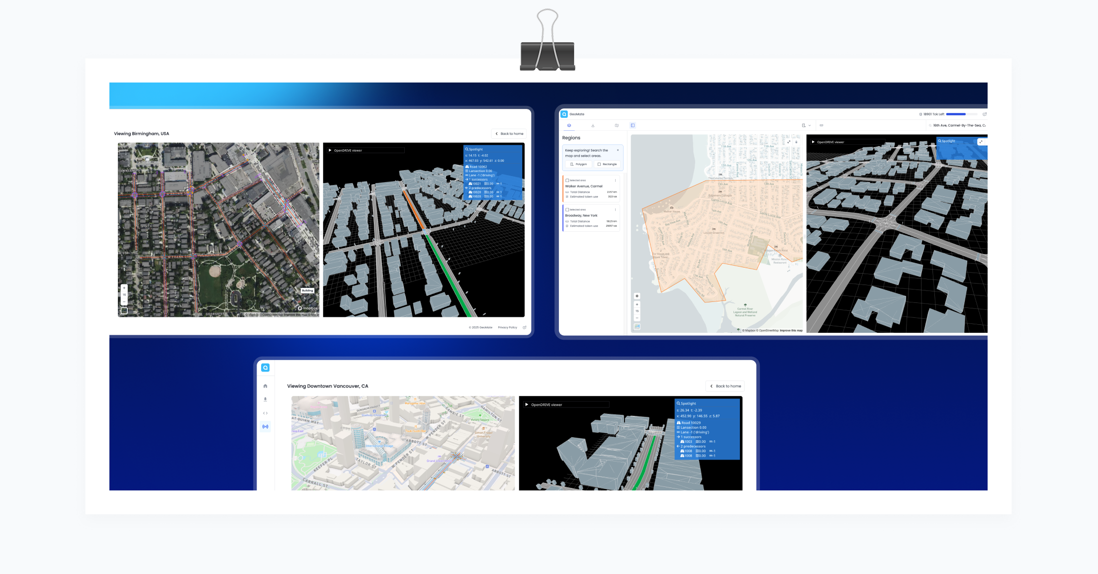
At the core of GeoMate’s platform is RealSimE, our simulation platform.
RealSimE creates a lane-accurate digital twin of a city’s road network including detailed, simulation-ready models that reflect how vehicles actually move through intersections, corridors, and neighborhoods. Because it operates at the lane level, it captures the turning movements, conflict points, intersection dynamics, queueing behavior, and spillback effects that traditional models often miss. It also reveals how local disruptions trigger network-wide rerouting.
This digital twin becomes a shared foundation across planning, operations, and safety teams - a single source of truth for traffic intelligence.
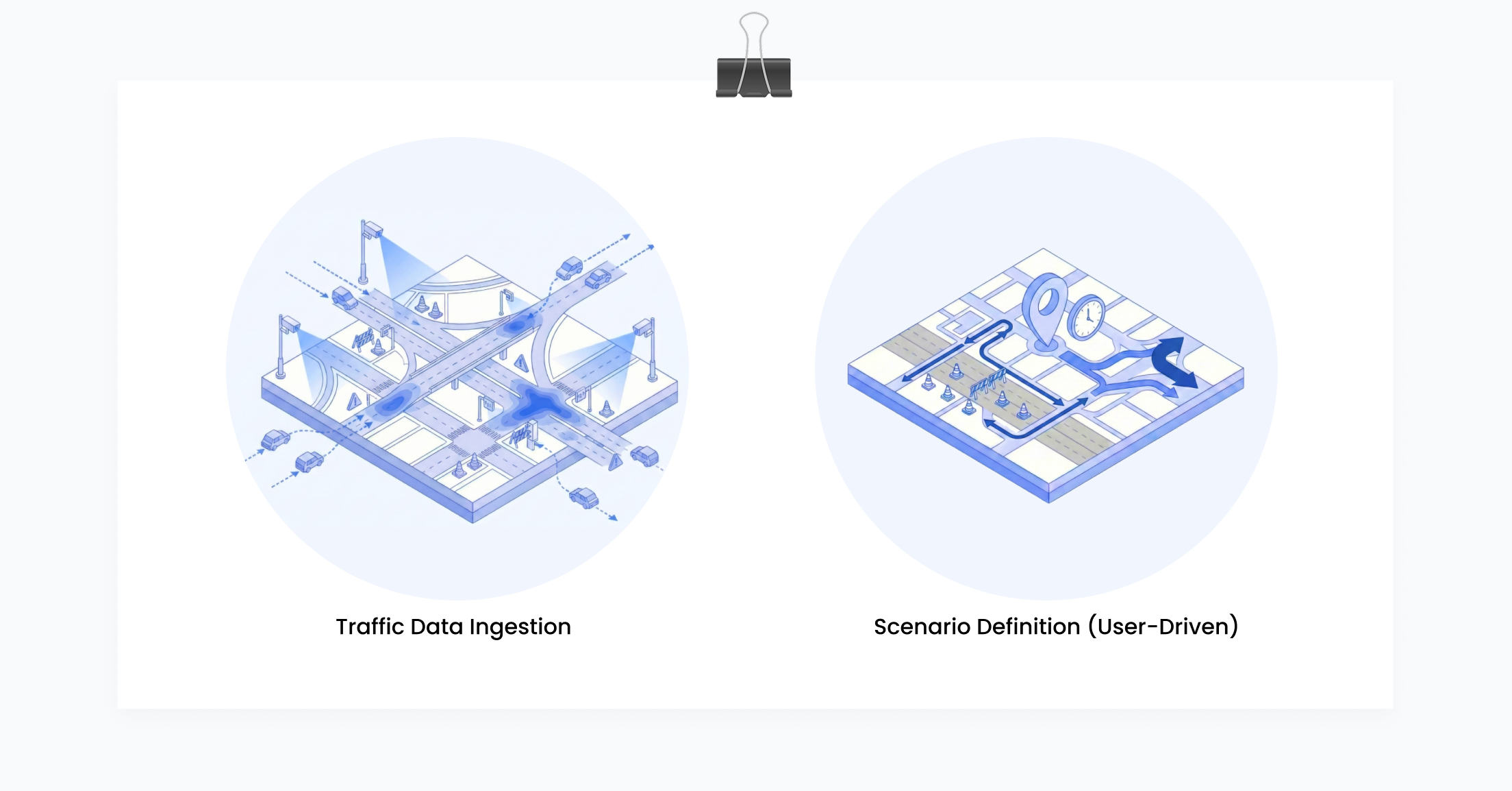
GeoMate’s platform turns raw traffic data into actionable insight through a structured, transparent process.
It begins by ingesting real-world data from multiple sources, including travel time feeds, sensor counts, historical traffic patterns, and construction or event information. This ensures simulations reflect actual operating conditions rather than theoretical assumptions.
From there, users create targeted “what-if” scenarios. These can include lane closures, detours, signal timing adjustments, transit priority changes, or demand shifts. Scenarios can be location-specific and time-specific, allowing for highly focused analysis.
The system then runs both micro- and meso-scale simulations. At the micro level, it models detailed vehicle behavior at intersections and corridors. At the meso level, it evaluates broader network impacts across neighborhoods and districts. This dual perspective provides both precision and system-wide awareness.
Finally, results are translated into clear performance metrics — identifying bottlenecks and congestion hotspots, measuring travel time reliability, highlighting safety risk indicators, and estimating CO₂ emissions impact. Decision-makers gain defensible, data-backed insight rather than theoretical projections.
With high-fidelity simulation in place, cities and mobility partners can move from uncertainty to clarity.
They can reduce unintended congestion caused by construction, improve transit reliability, identify and address safety hotspots, support sustainability reporting, and build public confidence through transparent, data-driven planning.
Instead of asking, “What do we think will happen?”
They can ask, “What does the data show will happen?”
Most organizations begin with a focused pilot project, often a priority corridor or a known congestion hotspot.
This allows teams to build a lane-level digital foundation, integrate available data sources, test real-world scenarios, and demonstrate measurable value before scaling. Once the foundation is in place, the system can expand across the broader network with minimal friction.
GeoMate transforms high-resolution geospatial imagery into precise, cost-effective HD maps and simulation environments. Through RealSimE, we help cities, consultants, and mobility operators make smarter decisions before deploying infrastructure - improving safety, efficiency, and sustainability across urban transportation systems.
Smarter mobility starts with better insight.
Better insight starts with simulation.

